Latitudo40 at the EC “Digital Challenge”

Latitudo40 in a nutshell
Founded in 2017 by 4 space industry experts and image analysis gurus, Latitudo 40 has combined the 20 years of experience of the “aged” founders to the multidisciplinary and young team which has grown to over 10 people. The team has now artificial intelligence, machine learning, image processing experts, UIX specialists, and business development professionals. Our vision is to give easy access to satellite images for everyone. We bring together data and algorithms from multiple sources and provide straightforward information to understand our planet from above.
Product description
The EarthAlytics cloud platform developed by Latitudo40 provides quick and easy access to all the information contained in Copernicus and Commercial High-Resolution satellite images. The platform is based on three fundamental pillars, access to the satellite catalogues of the main suppliers (Airbus, Planet, Maxar), process automation, and the use of AI/ML algorithms to analyse and interpret the images and user-friendly dashboards. Latitudo40 offers vertical solutions in the precision agriculture sector, urban planning, and monitoring, smart infrastructures.
The solution is characterised by a very simplified and intuitive customer journey, which allows access to the necessary monitoring information in just a few minutes.
The platform is designed to be simply integrated into any IT infrastructure of our customers, thanks to standard connectors, already available and usable with a Zero Code approach.
Hello Tomorrow Global Summit and the EC “Digital Challenge”
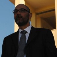
“Innovation is part of our DNA and, in addition to developing product activities, we like to take on new challenges in the international arena”, said Gaetano Volpe, CEO of the Latitudo40. The Latitudo40 team has decided to participate in the CEF Digital Innovation Challenge to test itself with the integration of open solutions (context broker, eDelivery, and Blockchain) offered by the European Commission.
They want to use open solutions as a tool to accelerate the development and scalability of the project.
During the first Bootcamp phase, the solutions were validated, and a pitch with the Urban Analytics application was presented.
They focused, among the available open solutions, on ContextBroker (to standardize the model of access to open data available in the municipalities and data lakes of our clients) and on Blockchain (to create a model of notarization of the information processed, to give greater transparency and reliability to our fully automated processing processes). Both challenges have been completed, they have started the process of fully integrating the solutions into the cloud platform.
Latitudo40 was among the finalists, together with CleverBooks and OpenContent, bringing for the first time a remote sensing solution with blockchain integration. The final result saw Latitudo40 arrive second, behind CleverBooks, but with great satisfaction.
The Digital Innovation Challenge allowed Latitudo40 to make their vision of easy access to remote sensing images as a tool to create sustainable and resilient cities known internationally and, above all, within the European Commission and CEF, through new applications that allow public decision-makers to make informed decisions.
Future Steps for Latitudo40
Their roadmap is very clear; they launched the product for the precision farming sector a few months ago. Also, they are preparing to launch the platform for urban monitoring in early 2021, for which they already have over 10 letters of interest from major European cities. They want to contribute to environmental sustainability and the fight against climate change. These battles must start from cities, which already host more than half the world’s population.


